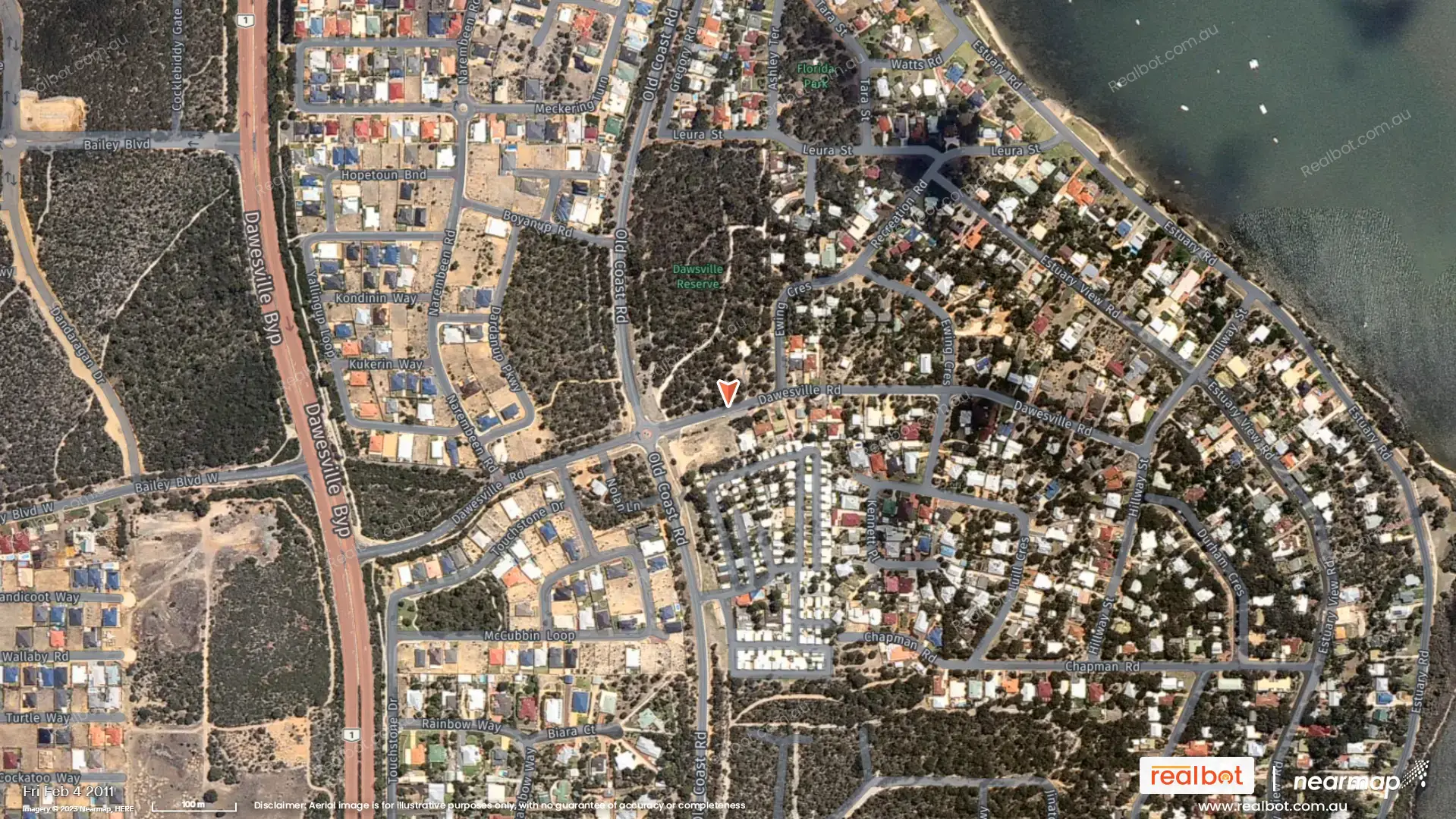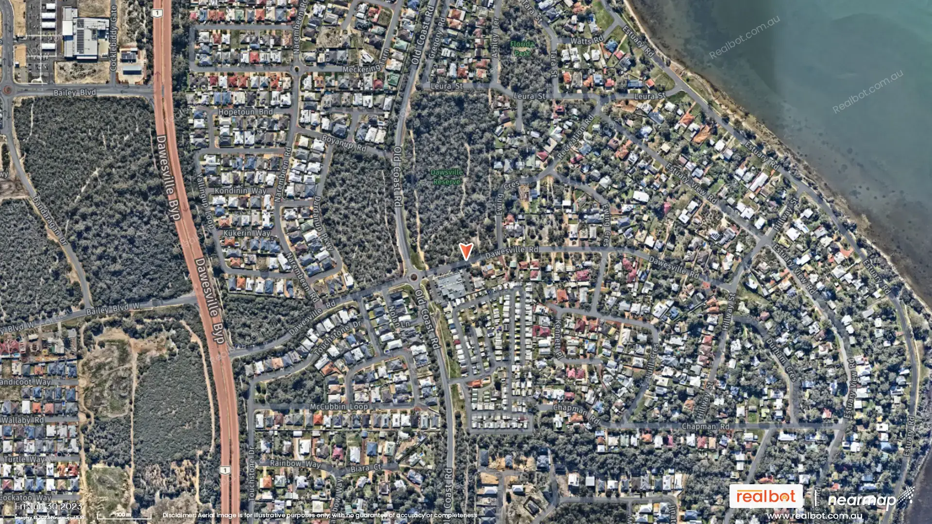
Dawesville, a coastal suburb nestled in Western Australia, has experienced significant transformation between 2016 and 2024. Analyzing high-resolution aerial maps reveals a story of substantial residential growth, infrastructural development, and evolving amenities, making it a compelling area for buyers, sellers, renters, and investors.
Engaging History & Initial State (circa 2016):
In 2016, Dawesville presented a mix of established homes interspersed with pockets of undeveloped land, particularly in the northern and western sections. The existing residential areas were primarily characterized by older, smaller homes, reflecting the suburb's more established character. The Dawesville Bypass, a major thoroughfare, already existed, acting as a significant artery connecting the suburb to broader Mandurah and beyond. However, development appeared to be somewhat fragmented, with larger tracts of undeveloped land separating existing housing clusters. The coastal area showed a higher density of established homes closer to the water.

Significant Changes & Development (2016-2024):
The most striking change between 2016 and 2024 is the considerable expansion of residential areas, particularly in the previously undeveloped northern and western sections. These new housing developments show a clear pattern of larger, modern homes, indicating a shift towards more contemporary housing preferences and an increase in overall property value. This expansion is evident in the substantial infill of previously vacant lots with new residential properties, demonstrating a period of strong growth and development. The roads and streets within these new subdivisions have been constructed, connecting seamlessly to the existing infrastructure.
Development of Amenities:
While a detailed analysis of the aerial imagery is needed to identify specific changes in amenities, the increase in residential density strongly suggests potential improvements or additions to existing infrastructure. This might include the addition of:
- New parks and recreational areas:Increased residential population usually necessitates additional green spaces and recreational facilities. The aerial imagery should provide visual clues to identify any newly created parks or open spaces.
- Improved road networks:The expansion of housing usually comes with upgraded road systems, potentially involving new roads, wider streets, or improved intersections to handle increased traffic flow.
- Expansion or addition of community facilities:New schools, shopping centers, or community centers may have been built to serve the growing population. High-resolution imagery allows for the identification of any new large-scale structures.

Opportunities for Buyers, Sellers, Renters & Investors:
The transformation of Dawesville offers a range of opportunities:
- Buyers:The growth in modern housing stock provides a wider choice of properties, catering to various preferences and budgets. The relative newness of a significant portion of the homes also indicates the presence of newer amenities and technologies.
- Sellers:The market’s evident growth could signify a strong seller’s market with potential for higher property values. However, it is important to analyze market data for precise price trends.
- Renters:Increased population brings higher demand for rental properties, potentially leading to higher rental yields for investors and increased opportunities for tenants.
- Investors:The development of new housing and infrastructure points towards a growing suburb with potential for strong capital appreciation in both land and property values.
Amenities & Lifestyle:
Dawesville boasts a desirable lifestyle centered around its stunning natural beauty. The proximity to the Peel-Harvey Estuary is evident, with its [mention waterfront features - e.g., beautiful beaches, scenic walking trails]. The aerial imagery also highlights the existing network of parks and reserves, perfect for recreation and outdoor activities. Recent developments suggest plans for [mention any new park development or recreation improvements based on the map].
Beyond natural beauty, Dawesville offers convenient access to:
- Schools: List primary and secondary schools if they are visible or near the area, and add their information here
- Shopping: List major shopping centers near the area and their specifics
- Transportation: Mention how close the suburb is to major transportation points
Investment Potential:
The combination of coastal living, ongoing development, and strong community spirit creates an appealing environment for investors. Based on recent data from [mention real estate data source], the median house price in Dawesville is [insert median price and date of data], indicating a [mention trend – e.g., steady, growing, or fluctuating] market. The influx of new housing, coupled with [mention any government initiatives promoting growth in the area, e.g., infrastructure projects], suggests positive future projections.
Government Initiatives:
Recent announcements from the [State Government Department or Agency] regarding [mention specific government initiatives affecting Dawesville - e.g., infrastructure projects, environmental protection measures] have further bolstered the suburb’s appeal and investment prospects. For specific details, refer to [provide links to official government announcements].
Dawesville WA 6211 has undergone remarkable transformation between 2016 and 2024. The extensive residential growth, coupled with the implied improvements in infrastructure and amenities, makes it a dynamic and attractive area for various market participants. Detailed analysis of the high-resolution aerial maps will reveal further specific changes, adding more precision to this assessment, and guiding stakeholders in making informed decisions. Further research into local council records and property market trends is crucial for a truly comprehensive understanding of the opportunities within Dawesville.
